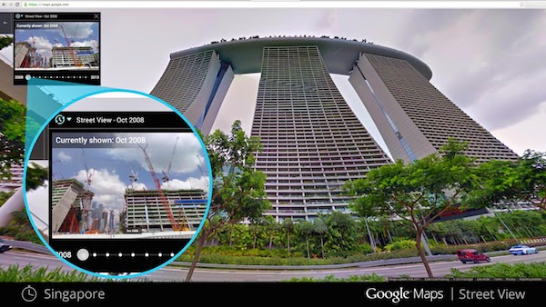
If you ever wish to go back in time to see how the world has changed before your very eye, here’s your chance. Google has just announced a new feature on its Google Maps Street View, bringing you back to yesteryear and allowing you to see what places used to look like all the way back to the year 2007.
Available on Google Maps for desktop, all you need to do is open up Street View of a particular location and if you see a clock icon in the upper left corner, click on it and you’ll see a slider. Move the slider through time and select a thumbnail to see how that very same place used to look like in previous years or seasons.
With the new feature, that isn’t available for me yet (at the time of writing), ti means that you can see the landmark’s growth from the ground up, like the Freedom Tower in New York City, the 2014 World Cup Stadium in Fortaleza, Brazil, or even see the amazing reconstruction of the devastating 2011 earthquake and tsunami in Onagawa, Japan.
Check out Google’s LatLong blog to find out more or check out Google Maps now to try it out.
Follow us on Instagram, Facebook, Twitter or Telegram for more updates and breaking news.


